The best hikes in Boulder, Colorado
About 155 miles of trail start within minutes of downtown. Here's which ones are worth your morning, how long each one really takes, and where you'll actually find a parking space.
Outdoor Boulder › Hiking in Boulder
If you've got one morning in Boulder, take Royal Arch from the Chautauqua Trailhead or the Mount Sanitas loop. Both are close to town, both give you the Flatirons, and both take most people two to three hours. If you've got a week, the rest of this page is the map: 40 trails with real numbers on them, sorted from flat creekside walking to summits over 8,500 feet, plus the parking, dog and season details that decide whether your plan survives contact with a Saturday morning.
Before you get in the car
- Trail miles
- About 155 miles of City of Boulder Open Space and Mountain Parks (OSMP) trail start within minutes of downtown, plus Boulder County open space and national forest higher up. We have full guides to 40 of those trails.
- Parking permit
- $5 a day or $25 a year, and only at seven OSMP fee areas. If your vehicle is registered in Boulder County you don't need one at all, and every other OSMP trailhead is free to park at.
- Chautauqua parking
- $2.50 an hour, 8 a.m. to 5 p.m., on summer weekends and holidays only. Free on weekdays, and free through fall, winter and spring. The trailhead lot has 48 standard spaces and is open 5 a.m. to 11 p.m.
- The free shuttle
- The Park-to-Park shuttle runs to Chautauqua every 30 minutes, 8 a.m. to 8 p.m., on weekends and summer holidays. The 2026 season runs Saturday, May 23 through Monday, Sept. 7.
- Dogs
- Leashed almost everywhere. Off leash only on designated City OSMP trails, and only with a Voice and Sight tag, which OSMP says can take up to a month to get. Boulder County trails are leash-only with no exceptions.
- Altitude
- Town sits at about 5,430 feet and the summits above it run past 8,500. Give yourself an easy first day, drink more than you would at home, and save the big climb for day two.
- Summer timing
- Thunderstorms build fast over the Front Range on summer afternoons. Start early enough to be off exposed ridges and summits by early afternoon.
Every trail, with the numbers that matter
Three tables, ordered by how hard the trail is, not by how famous. Distance, elevation gain, difficulty rating, dog rules and parking fee all come from the agency that manages the land, and every row links to the full guide. Typical time is our own working, from the published distance and climb, so you can judge a trail against your afternoon before you commit to it.
Where a cell says "Not published", that's the honest state of things: the City of Boulder, Boulder County and the Forest Service each publish different amounts of detail, and several well-loved trails have no official mileage at all. Borrowing a number from a crowdsourced app would fill the gap and make the table less true, so we leave it open. If you want the difficulty ratings decoded, our guide to Boulder trail difficulty explains what each agency means by "moderate".
Easy hikes in Boulder
Flat, short, paved, or gentle enough for kids, grandparents and a first day at altitude. Several of these are walkable or reachable by bus from downtown.
| Trail | Distance | Elevation gain | Typical time | Difficulty | Dogs | Fee |
|---|---|---|---|---|---|---|
| Boulder Creek Path | ~5.5 mi one way | Minimal | 2.5 to 3.5 hr one way | Easy | Leash | Free |
| Wonderland Lake | Not published | Not published | Not enough published data | Easy | Leash or V&S tag | Free |
| Coot Lake | 1.2 mi loop | Minimal | 30 to 45 min | Easy | Leash or V&S tag | Free |
| Sawhill Ponds | Not published | Minimal | Not enough published data | Easy | Leash | Free |
| Bluebell-Baird Trail | 0.7 mi | Not published | Not enough published data | Easy | Leash or V&S tag | Free |
| Marshall Mesa | 2.7 mi loop | Gentle | 1 to 2 hr | Easy to medium | Leash or V&S tag | See guide |
| Sanitas Valley Trail | 1.25 mi | Not published | Not enough published data | Easy to medium | Leash or V&S tag | Free |
| Eagle Trail | 3.2 mi | 449 ft | 1.5 to 2.5 hr | Easy/Medium | Leash or V&S tag | Free |
| Fowler Trail | 0.9 mi one way | 280 ft | 30 to 45 min one way | Easy | Leash | Parking fee |
| Red Rocks Trail | 0.5 mi | 294 ft | 20 to 30 min | Easy/Medium | Leash or V&S tag | Free |
| Doudy Draw | 2.2 mi | Not published | Not enough published data | Easy to medium | Leash or V&S tag | Parking fee |
| Boulder Canyon Trail | 2.5 mi one way | ~330 ft | 1.5 to 2 hr one way | Easy | Leash | Free |
| South Boulder Creek Trail | 3.4 mi | 248 ft | 1.5 to 2.5 hr | Easy/Medium | Leash or V&S tag | Free |
- Boulder Creek Path
- Distance
- ~5.5 mi one way
- Elevation gain
- Minimal
- Typical time
- 2.5 to 3.5 hr one way
- Difficulty
- Easy
- Dogs
- Leash
- Fee
- Free
- Wonderland Lake
- Distance
- Not published
- Elevation gain
- Not published
- Typical time
- Not enough published data
- Difficulty
- Easy
- Dogs
- Leash or V&S tag
- Fee
- Free
- Coot Lake
- Distance
- 1.2 mi loop
- Elevation gain
- Minimal
- Typical time
- 30 to 45 min
- Difficulty
- Easy
- Dogs
- Leash or V&S tag
- Fee
- Free
- Sawhill Ponds
- Distance
- Not published
- Elevation gain
- Minimal
- Typical time
- Not enough published data
- Difficulty
- Easy
- Dogs
- Leash
- Fee
- Free
- Bluebell-Baird Trail
- Distance
- 0.7 mi
- Elevation gain
- Not published
- Typical time
- Not enough published data
- Difficulty
- Easy
- Dogs
- Leash or V&S tag
- Fee
- Free
- Marshall Mesa
- Distance
- 2.7 mi loop
- Elevation gain
- Gentle
- Typical time
- 1 to 2 hr
- Difficulty
- Easy to medium
- Dogs
- Leash or V&S tag
- Fee
- See guide
- Sanitas Valley Trail
- Distance
- 1.25 mi
- Elevation gain
- Not published
- Typical time
- Not enough published data
- Difficulty
- Easy to medium
- Dogs
- Leash or V&S tag
- Fee
- Free
- Eagle Trail
- Distance
- 3.2 mi
- Elevation gain
- 449 ft
- Typical time
- 1.5 to 2.5 hr
- Difficulty
- Easy/Medium
- Dogs
- Leash or V&S tag
- Fee
- Free
- Fowler Trail
- Distance
- 0.9 mi one way
- Elevation gain
- 280 ft
- Typical time
- 30 to 45 min one way
- Difficulty
- Easy
- Dogs
- Leash
- Fee
- Parking fee
- Red Rocks Trail
- Distance
- 0.5 mi
- Elevation gain
- 294 ft
- Typical time
- 20 to 30 min
- Difficulty
- Easy/Medium
- Dogs
- Leash or V&S tag
- Fee
- Free
- Doudy Draw
- Distance
- 2.2 mi
- Elevation gain
- Not published
- Typical time
- Not enough published data
- Difficulty
- Easy to medium
- Dogs
- Leash or V&S tag
- Fee
- Parking fee
- Boulder Canyon Trail
- Distance
- 2.5 mi one way
- Elevation gain
- ~330 ft
- Typical time
- 1.5 to 2 hr one way
- Difficulty
- Easy
- Dogs
- Leash
- Fee
- Free
- South Boulder Creek Trail
- Distance
- 3.4 mi
- Elevation gain
- 248 ft
- Typical time
- 1.5 to 2.5 hr
- Difficulty
- Easy/Medium
- Dogs
- Leash or V&S tag
- Fee
- Free
Figures come from the managing agency, and every row links to the full guide. Where a cell says Not published, that agency doesn't publish an official number for it and we'd rather say so than borrow one. Typical time is the one column that isn't the agency's: no land manager around Boulder publishes hiking times, so we work it out from the published distance and climb at two miles an hour plus half an hour per 1,000 feet, and we leave it blank when either number is missing. Treat it as a planning range, not a promise.
Moderate hikes in Boulder
Boulder's terrain tends to jump from flat valley floor straight to steep foothill, so genuinely moderate hikes are rarer here than you'd expect. These give you real elevation and a view without turning into an all-day effort. The last four are high-country lakes, which means a drive and a much shorter season.
| Trail | Distance | Elevation gain | Typical time | Difficulty | Dogs | Fee |
|---|---|---|---|---|---|---|
| Chautauqua Trail | Not published | Not published | Not enough published data | Moderate | Leash or V&S tag | Paid parking |
| Gregory Canyon | Not published | Not published | Not enough published data | Moderate | Leash or V&S tag | Parking fee |
| Dakota Ridge Trail | 1.4 mi one way | 574 ft | 1 to 1.5 hr one way | Easy to medium | Leash or V&S tag | Free |
| Skunk Canyon | 1.4 mi | 597 ft | 1 to 1.5 hr | Easy/Medium | Leash on NCAR land | Free |
| North Sky Trail | 3.63 mi | 495 ft | 2 to 2.5 hr | Hard | No dogs May 1-Jul 31 | Free |
| Mallory Cave | Not published | Not published | Not enough published data | Moderate | Leash or V&S tag | Free |
| Anne U. White Trail | 1.7 mi one way | Not published | Not enough published data | Moderate | Leash | Free |
| Community Ditch Trail | 3.9 mi | 393 ft | 2 to 3 hr | Easy/Medium | Leash | See guide |
| Lost Lake | Not published | Not published | Not enough published data | Moderate | Leash at all times | Free shuttle in season |
| Lake Isabelle | 4.4 mi round trip | Not published | Not enough published data | Moderate at altitude | Leash at all times | Timed entry |
| Diamond Lake | 5.4 mi round trip | ~900 ft | 3 to 4 hr | Moderate | Leash at all times | See guide |
| Blue Lake | ~5 mi round trip | 850-1,000 ft | 2.5 to 4 hr | Moderate to strenuous | Leash at all times | Timed entry |
- Chautauqua Trail
- Distance
- Not published
- Elevation gain
- Not published
- Typical time
- Not enough published data
- Difficulty
- Moderate
- Dogs
- Leash or V&S tag
- Fee
- Paid parking
- Gregory Canyon
- Distance
- Not published
- Elevation gain
- Not published
- Typical time
- Not enough published data
- Difficulty
- Moderate
- Dogs
- Leash or V&S tag
- Fee
- Parking fee
- Dakota Ridge Trail
- Distance
- 1.4 mi one way
- Elevation gain
- 574 ft
- Typical time
- 1 to 1.5 hr one way
- Difficulty
- Easy to medium
- Dogs
- Leash or V&S tag
- Fee
- Free
- Skunk Canyon
- Distance
- 1.4 mi
- Elevation gain
- 597 ft
- Typical time
- 1 to 1.5 hr
- Difficulty
- Easy/Medium
- Dogs
- Leash on NCAR land
- Fee
- Free
- North Sky Trail
- Distance
- 3.63 mi
- Elevation gain
- 495 ft
- Typical time
- 2 to 2.5 hr
- Difficulty
- Hard
- Dogs
- No dogs May 1-Jul 31
- Fee
- Free
- Mallory Cave
- Distance
- Not published
- Elevation gain
- Not published
- Typical time
- Not enough published data
- Difficulty
- Moderate
- Dogs
- Leash or V&S tag
- Fee
- Free
- Anne U. White Trail
- Distance
- 1.7 mi one way
- Elevation gain
- Not published
- Typical time
- Not enough published data
- Difficulty
- Moderate
- Dogs
- Leash
- Fee
- Free
- Community Ditch Trail
- Distance
- 3.9 mi
- Elevation gain
- 393 ft
- Typical time
- 2 to 3 hr
- Difficulty
- Easy/Medium
- Dogs
- Leash
- Fee
- See guide
- Lost Lake
- Distance
- Not published
- Elevation gain
- Not published
- Typical time
- Not enough published data
- Difficulty
- Moderate
- Dogs
- Leash at all times
- Fee
- Free shuttle in season
- Lake Isabelle
- Distance
- 4.4 mi round trip
- Elevation gain
- Not published
- Typical time
- Not enough published data
- Difficulty
- Moderate at altitude
- Dogs
- Leash at all times
- Fee
- Timed entry
- Diamond Lake
- Distance
- 5.4 mi round trip
- Elevation gain
- ~900 ft
- Typical time
- 3 to 4 hr
- Difficulty
- Moderate
- Dogs
- Leash at all times
- Fee
- See guide
- Blue Lake
- Distance
- ~5 mi round trip
- Elevation gain
- 850-1,000 ft
- Typical time
- 2.5 to 4 hr
- Difficulty
- Moderate to strenuous
- Dogs
- Leash at all times
- Fee
- Timed entry
Figures come from the managing agency, and every row links to the full guide. Where a cell says Not published, that agency doesn't publish an official number for it and we'd rather say so than borrow one. Typical time is the one column that isn't the agency's: no land manager around Boulder publishes hiking times, so we work it out from the published distance and climb at two miles an hour plus half an hour per 1,000 feet, and we leave it blank when either number is missing. Treat it as a planning range, not a promise.
Hard hikes and big days in Boulder
Sustained climbing, rocky footing, and a summit or a landmark at the end. Start these early in summer, both for the parking and to be off the exposed sections before the afternoon storms build.
| Trail | Distance | Elevation gain | Typical time | Difficulty | Dogs | Fee |
|---|---|---|---|---|---|---|
| Mount Sanitas | 3.3 mi loop | 1,323 ft | 2 to 3 hr | Hard | Leash or V&S tag | Free |
| Lion's Lair | 2.7 mi one way | 1,228 ft | 2 to 2.5 hr one way | Medium/Hard | No dogs | Free |
| Royal Arch Trail | 3.4 mi round trip | 1,153 ft | 2 to 3 hr | Medium/Hard | Leash or V&S tag | Paid parking |
| Anemone Loop Trail | 3.4 mi | 630 ft | 2 to 2.5 hr | Hard | Leash or V&S tag | Free |
| Saddle Rock Trail | 1.3 mi | 1,482 ft | 1.5 to 2 hr | Hard | Leash or V&S tag | Parking fee |
| Bear Canyon Trail | 1.9 mi (segment) | 1,363 ft | Not enough published data | Hard | Leash on NCAR land | Free |
| Green Mountain | Not published | Not published | Not enough published data | Hard | Leash or V&S tag | Paid parking |
| Bear Peak | 4.7 mi round trip | 2,800-3,000 ft | 3.5 to 5 hr | Hard | Leash or V&S tag | Free |
| South Boulder Peak | Not published | Not published | Not enough published data | Hard | Leash or V&S tag | Free |
| Shadow Canyon | Not published | Not published | Not enough published data | Hard | Leash or V&S tag | Free |
| Fern Canyon | Not published | ~1,700 ft | Not enough published data | Hard | Leash or V&S tag | Free |
| Walker Ranch | 7.9 mi loop | 1,400-1,600 ft | 4 to 6 hr | Strenuous | Leash | Free |
| Arapaho Glacier Trail | 7.4 mi round trip | ~2,600 ft | 4.5 to 6.5 hr | Strenuous | Leash at all times | See guide |
| Devils Thumb Lake | 10.5-11 mi round trip | 2,400-2,500 ft | 6 to 8.5 hr | Strenuous | Leash at all times | See guide |
| Boulder Skyline Traverse | 16-17 mi (unofficial) | ~5,900 ft reported | Not enough published data | Very hard | Varies; no dogs on some links | Parking fee |
- Mount Sanitas
- Distance
- 3.3 mi loop
- Elevation gain
- 1,323 ft
- Typical time
- 2 to 3 hr
- Difficulty
- Hard
- Dogs
- Leash or V&S tag
- Fee
- Free
- Lion's Lair
- Distance
- 2.7 mi one way
- Elevation gain
- 1,228 ft
- Typical time
- 2 to 2.5 hr one way
- Difficulty
- Medium/Hard
- Dogs
- No dogs
- Fee
- Free
- Royal Arch Trail
- Distance
- 3.4 mi round trip
- Elevation gain
- 1,153 ft
- Typical time
- 2 to 3 hr
- Difficulty
- Medium/Hard
- Dogs
- Leash or V&S tag
- Fee
- Paid parking
- Anemone Loop Trail
- Distance
- 3.4 mi
- Elevation gain
- 630 ft
- Typical time
- 2 to 2.5 hr
- Difficulty
- Hard
- Dogs
- Leash or V&S tag
- Fee
- Free
- Saddle Rock Trail
- Distance
- 1.3 mi
- Elevation gain
- 1,482 ft
- Typical time
- 1.5 to 2 hr
- Difficulty
- Hard
- Dogs
- Leash or V&S tag
- Fee
- Parking fee
- Bear Canyon Trail
- Distance
- 1.9 mi (segment)
- Elevation gain
- 1,363 ft
- Typical time
- Not enough published data
- Difficulty
- Hard
- Dogs
- Leash on NCAR land
- Fee
- Free
- Green Mountain
- Distance
- Not published
- Elevation gain
- Not published
- Typical time
- Not enough published data
- Difficulty
- Hard
- Dogs
- Leash or V&S tag
- Fee
- Paid parking
- Bear Peak
- Distance
- 4.7 mi round trip
- Elevation gain
- 2,800-3,000 ft
- Typical time
- 3.5 to 5 hr
- Difficulty
- Hard
- Dogs
- Leash or V&S tag
- Fee
- Free
- South Boulder Peak
- Distance
- Not published
- Elevation gain
- Not published
- Typical time
- Not enough published data
- Difficulty
- Hard
- Dogs
- Leash or V&S tag
- Fee
- Free
- Shadow Canyon
- Distance
- Not published
- Elevation gain
- Not published
- Typical time
- Not enough published data
- Difficulty
- Hard
- Dogs
- Leash or V&S tag
- Fee
- Free
- Fern Canyon
- Distance
- Not published
- Elevation gain
- ~1,700 ft
- Typical time
- Not enough published data
- Difficulty
- Hard
- Dogs
- Leash or V&S tag
- Fee
- Free
- Walker Ranch
- Distance
- 7.9 mi loop
- Elevation gain
- 1,400-1,600 ft
- Typical time
- 4 to 6 hr
- Difficulty
- Strenuous
- Dogs
- Leash
- Fee
- Free
- Arapaho Glacier Trail
- Distance
- 7.4 mi round trip
- Elevation gain
- ~2,600 ft
- Typical time
- 4.5 to 6.5 hr
- Difficulty
- Strenuous
- Dogs
- Leash at all times
- Fee
- See guide
- Devils Thumb Lake
- Distance
- 10.5-11 mi round trip
- Elevation gain
- 2,400-2,500 ft
- Typical time
- 6 to 8.5 hr
- Difficulty
- Strenuous
- Dogs
- Leash at all times
- Fee
- See guide
- Boulder Skyline Traverse
- Distance
- 16-17 mi (unofficial)
- Elevation gain
- ~5,900 ft reported
- Typical time
- Not enough published data
- Difficulty
- Very hard
- Dogs
- Varies; no dogs on some links
- Fee
- Parking fee
Figures come from the managing agency, and every row links to the full guide. Where a cell says Not published, that agency doesn't publish an official number for it and we'd rather say so than borrow one. Typical time is the one column that isn't the agency's: no land manager around Boulder publishes hiking times, so we work it out from the published distance and climb at two miles an hour plus half an hour per 1,000 feet, and we leave it blank when either number is missing. Treat it as a planning range, not a promise.
Parking at Boulder trailheads, and which lots fill first
Parking is the part of a Boulder hike most likely to go wrong, and it's also the part that's easiest to get right once you know the system. There are three separate rulebooks in play, depending on whose land you're parking on.
The OSMP parking permit, and whether it applies to you
City of Boulder Open Space and Mountain Parks charges for parking at seven areas: Flagstaff Mountain (including Gregory Canyon at the base of Flagstaff Road), Doudy Draw, Flatirons Vista, Greenbelt Plateau, Marshall Mesa, South Boulder Creek West and South Mesa. Every other OSMP trailhead is free.
Here's the part that catches visitors. The fee applies only to vehicles that are not registered in Boulder County. A local parks free at those lots and you don't, at the same trailhead, on the same afternoon. A daily permit is $5 and covers every OSMP fee trailhead on the day you buy it, so if the lot you paid for turns out to be full you can drive to another one on the same permit. An annual permit is $25. You buy the daily one through the ParkMobile app using the lot's zone number, or at the parking area itself, and online transactions add a $1.50 charge that doesn't go to the city.
There's no hangtag to display. The permit is tied to one license plate and isn't transferable between vehicles. Rangers do patrol, and the city's rules page says violations may result in a summons or a fine, though it doesn't publish a set amount, so we're not going to quote you one. Full detail, including every ParkMobile zone number, is in our OSMP parking permit guide and the wider Boulder trailhead parking guide.
Chautauqua, and the free shuttle that solves it
Chautauqua is the busiest trailhead in Boulder and it runs on its own system, separate from the OSMP permit. The trailhead lot by the Ranger Cottage holds 48 standard spaces, plus limited street parking around the lawn, and it's open 5 a.m. to 11 p.m. On summer weekends and holidays, during the shuttle season, parking there costs $2.50 an hour from 8 a.m. to 5 p.m., in the green parking areas, along Baseline Road near the park, in the Ranger Cottage lot, and in the neighborhood north of the park. There's no time limit on how long you stay. Weekdays are free. So is the whole of fall, winter and spring. Vehicles with a Chautauqua Neighborhood Parking Permit are exempt, and accessible parking in the Ranger Cottage lot and around the green area is free.
Forty-eight spaces is the number to keep in your head, because it explains everything about a summer Saturday there. The lot fills very early, and by mid-morning you'll be circling. The fix the city built for exactly this is the free Park-to-Park shuttle: every 30 minutes, 8 a.m. to 8 p.m., on weekends and summer holidays, picking up at 19 marked stops around downtown, University Hill and Broadway, including the downtown city parking garages. In 2026 it runs Saturday, May 23 through Monday, Sept. 7. Park downtown, ride in, and skip the whole problem. Our Chautauqua parking and shuttle guide has the stop list, and the city runs live trailhead cameras so you can look at the lot before you drive to it.
Hessie, Brainard and Eldorado, where the season decides
Up the canyons the constraint stops being fees and starts being capacity. Roadside parking at the Hessie Trailhead above Nederland fills very early in season, and Boulder County allows it only between the marked signs: park outside them and it's a $50 fine or a tow. The county's free shuttle runs from Nederland High School on Fridays, Saturdays, Sundays and holidays, May 22 through Oct. 11, 2026, starting at 6 a.m. every service day. That's the realistic way in on a summer weekend. The Brainard Lake Recreation Area, which is how you reach Lake Isabelle, Blue Lake and Mitchell Lake, runs timed entry in season, and it books out, so that one needs planning days ahead rather than the morning of. Eldorado Canyon State Park needs a Colorado parks pass and has its own reservation system. Heading into the Indian Peaks Wilderness for a night? Check the permit rules first.
No car? Several Boulder trailheads are genuinely reachable on foot or by bus, and we've mapped which ones in hiking Boulder without a car.
One caution on dates and prices. Shuttle seasons, timed entry windows and fees change from year to year, and they sometimes change mid-season. The figures above are the 2026 ones as published by the City of Boulder, Boulder County and the Forest Service, and every one of them is linked to its source at the bottom of this page. Check the agency page before a long drive.
Dogs on Boulder trails, and what the Voice and Sight tag really covers
Boulder is one of the best hiking towns in the country to have a dog in, and the rules are more specific than almost anywhere else, which is why out-of-town guides get them wrong. The whole thing turns on one question: whose land are you standing on?
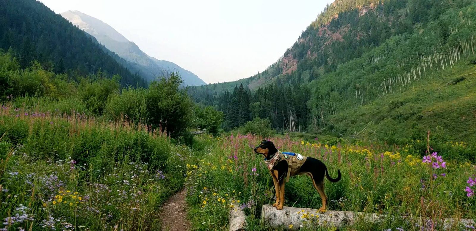
City of Boulder OSMP: the Voice and Sight tag
On City OSMP land, roughly 155 miles of trail exist and about 89 percent of it is open to dogs on leash. A subset of that is open to off-leash dogs that carry a Voice and Sight tag. The tag isn't something you buy at the trailhead. To enroll you complete a free online education course, which the law requires you to retake every five years, verify a City of Boulder dog license or current rabies vaccination for each dog, then pay the fee and register. OSMP says the whole process can take up to a month, and tags expire December 31 every year, so this is a thing to sort out before your trip, not in the parking lot.
Once you have it, the standard is strict, and it's what rangers actually enforce. Your dog has to stay in your sight and under voice control at all times and come to you immediately when called, and never charge, chase or show aggression toward people, dogs, wildlife or livestock. You have to carry a leash for each dog you're walking, and you can manage no more than two dogs under voice and sight control at once. Fines for City violations run to a maximum of $100 for a first offense, $200 for a second within 24 months, and at least $300 for a third, and courts can suspend off-leash privileges. If your dog's recall isn't reliable, it isn't ready for this, tag or not.
Two rules apply on City land even with a tag. Under the Trailhead Leash Program, your dog is leashed the moment you step out of the car and stays leashed through the trailhead area. And on some trails, seasonal leash restrictions apply from May 1 to July 31 and again from August 15 to December 1, to protect ground-nesting birds and bears. Posted signs and the OSMP dog regulations map show which.
Boulder County: leash only, no exceptions
Boulder County Parks and Open Space runs a completely separate system with no off-leash program. County trails are leash-only, full stop, and a City of Boulder Voice and Sight tag gives you nothing there. That includes places people often assume are city land, like Walker Ranch and Rabbit Mountain. When you can't tell who manages a trail, treat it as leash-only until a sign or a guide says otherwise.
Where dogs aren't allowed at all
Driving out with the dog and getting turned around at the trailhead is a common Boulder mistake, so these are worth memorizing:
- Hall Ranch near Lyons: no dogs on any trail, including Bitterbrush, Nighthawk and the Nelson Loop.
- Heil Valley Ranch near Lyons: no dogs on any trail.
- Lion's Lair, the switchbacking route up Mount Sanitas: no dogs, even though the rest of the Sanitas trails allow them.
- North Sky Trail: no dogs May 1 through July 31, leashed the rest of the year.
- Boulder Reservoir: no dogs through the gates or along the south shoreline from May 15 through Labor Day. In the off-season they're allowed on leash, and the Voice and Sight tag doesn't apply.
Up in the national forest, around Brainard Lake and the Indian Peaks, dogs are on a hand-held leash at all times. Our guide to hiking with dogs in Boulder goes through the tag process step by step, and the best dog-friendly hikes picks the trails where a dog has the best day.
What's open when: hiking Boulder through the year
Boulder sits where the plains meet the mountains, so at any moment there are two seasons running at once: whatever it's doing in town, and whatever it's doing a few thousand feet higher up the canyon. Timing a hike here is mostly a matter of knowing which of those two you're hiking in.
Spring, March to May
The most variable stretch of the year, and the one visitors misjudge most. Some of the biggest Front Range snowstorms land in March and April, so an April hike up high is a snow hike whatever the forecast in town says. The foothills right above the city dry out first, which is the whole strategy for spring: stay low, stay on well-drained trails like Marshall Mesa, and let the peaks finish melting. Up high this is mud season, when soft tread damages easily, so it's worth staying off it for the trail's sake as much as your own.
Summer, June to August
The only window when the whole landscape is open at once, valley floor to alpine. The high lakes around Brainard and the Indian Peaks typically hold snow into June and melt out around July, which is when Lake Isabelle and Blue Lake come into their own. Two things shape a good summer day. Afternoon thunderstorms build fast, and lightning on an exposed ridge or summit is the real hazard, so plan to be off high open terrain by early afternoon and save the summits for the morning. And the lower trails get genuinely hot and sun-exposed in the middle of the day, which is another argument for starting at dawn. Our thunderstorm safety guide covers what to do when one catches you anyway.
Fall, September to October
For a lot of locals this is the season. Cool, dry, stable air, crisp mornings, gold aspens up the canyons, and thinner trailhead crowds once the summer rush ends. If you get to choose when you come to Boulder to hike, choose this. Start with the best fall hikes.
Winter, November to February
Boulder gets a lot of winter sun, and the lower, south-facing foothill trails often stay snow-free or melt clear between storms, so you can hike in town year-round. Traction devices are worth carrying for shaded switchbacks and north-facing sections, which hold ice long after the sunny stretches have dried. For actual snow, head up toward Nederland. Our winter picks name the low-elevation trails that work, and when to visit Boulder for the outdoors lays out the full season-by-season picture.
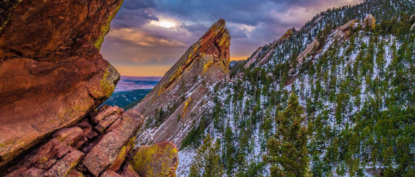
Altitude, and how to feel good on your first hike
Boulder sits at about 5,430 feet and its trails go up from there. Bear Peak tops out around 8,461 feet, and the Indian Peaks lakes above Brainard sit over 10,000. Thinner, drier air is the whole story: you lose water faster through your breath and skin without feeling especially thirsty, the sun burns you quicker because there's less atmosphere filtering it, and a hard effort feels harder than the same effort at home.
None of that has to slow you down. Give yourself an easy first day, something flat and scenic. Drink more than you would at sea level and start before you're thirsty, with a salty snack to help you hold onto it. Wear sunscreen, a hat and sunglasses even when it's cool, because Boulder is sunny in every season. Then take the big climb on day two, once you've had a night to adjust.
The most common early sign of mild altitude illness is a headache, sometimes with nausea, fatigue, dizziness or trouble sleeping. The CDC notes symptoms are most common above about 8,000 feet, which is exactly where Boulder's summits and the Indian Peaks lakes sit. The rule of thumb is simple: if you have symptoms, stop climbing, and if they get worse, go down. Descending is the most reliable way to feel better. This is general planning information and not medical advice, so if you have a heart or lung condition, are pregnant, or have had altitude illness before, talk with your own clinician before the trip. Our altitude and hydration guide goes deeper, and what to bring hiking in Boulder covers the water, layers and sun gear.
Moving here, not just visiting? Our sister site covers what a year at this elevation feels like, in living in Boulder, Colorado.
The trails people ask for by name
Mount Sanitas
A 3.3-mile loop with 1,323 feet of gain, starting a mile from downtown. OSMP rates it hard and it deserves that: the east ridge is a rock staircase that climbs relentlessly, and the descent down Sanitas Valley is where most people's knees remember it. Two to three hours for most. Parking at the Centennial Trailhead is free, but it holds 31 standard spaces plus 2 ADA spaces and fills early on weekend mornings. If you want the summit without the staircase, Lion's Lair spreads the same sort of climbing over 2.7 miles of smooth switchbacks one way, and it's the one Sanitas route that allows no dogs. For a flat walk with the same view of the ridge, take the Sanitas Valley Trail and turn around whenever you like. Full guide: Mount Sanitas.
Royal Arch
The classic Boulder hike, and the one most visitors mean when they say they want to hike the Flatirons. OSMP publishes 3.4 miles round trip with 1,153 feet of gain on the Royal Arch Trail itself, plus 431 feet on the Bluebell Road approach from the Chautauqua Trailhead, and rates it medium to hard. It climbs steeply, drops briefly, then climbs again to a natural sandstone arch you can stand under with the city laid out below. Two to three hours. It starts from Chautauqua, so read the parking section above before you plan a summer Saturday around it. Dogs are allowed on leash, or off leash with a Voice and Sight tag. Full guide: Royal Arch Trail.
The Chautauqua Trailhead
Chautauqua is the front door to the Flatirons, and four of Boulder's best-known trails leave from it: the Chautauqua Trail straight up the meadow, the gentle Bluebell-Baird Trail, the Flatirons Loop, and Royal Arch, with connections deeper into OSMP toward Green Mountain. Dogs are leashed in the trailhead area and around the historic buildings, and can go off leash on designated trails beyond it with a tag. Everything we publish about Chautauqua is trail-side: the trailhead, the parking, the shuttle and the routes, in our Chautauqua Park trail guide. The other half of Chautauqua, the concerts in the 1898 auditorium, the dining hall, Winterfest and the National Historic Landmark grounds, belongs to our sister site, Boulder Things To Do, and lives in its guide to Boulder festivals by season.
Green Mountain, Bear Peak and South Boulder Peak
The three summits on Boulder's skyline, in ascending order of height and effort. Green Mountain at 8,144 feet is the local rite of passage, with a summit peak-finder naming what you can see. Bear Peak at 8,461 feet is a 4.7-mile round trip with roughly 2,800 to 3,000 feet of climbing and a short rock scramble at the top, three and a half to five hours. South Boulder Peak at 8,549 feet is the highest and least traveled, reached up steep Shadow Canyon. Do all five skyline summits in a day and you've done the Boulder Skyline Traverse, an unofficial route no agency publishes numbers for, which is why ours say "reported".
The Mesa Trail and NCAR
The long, rolling trail that runs the length of the Flatirons from Chautauqua south to South Mesa, feeding almost every canyon climb along the way. You can take any bite of it you like, which is what makes it useful: an hour out and back, or a full traverse with a car shuttle. The NCAR trailhead is the easiest mid-point entry, and dogs are leash-only on NCAR property regardless of any tag.
Lake Isabelle and the Indian Peaks
When people picture alpine Colorado, this is it: Lake Isabelle is a 4.4-mile round trip from Brainard Lake through wildflowers to a lake under the Divide, moderate but at real altitude. It needs a timed-entry reservation in season and the season is short, roughly July through September. Blue Lake is the next one from the same basin, about 5 miles round trip with 850 to 1,000 feet of climbing. Diamond Lake sits in the next basin south and starts from the Fourth of July Trailhead above Eldora instead, so it needs no Brainard reservation, just a rough drive. Dogs are on a hand-held leash at all times up here. More at the best lake hikes near Boulder.
Pick a hike by what you're after
Sorted by difficulty is one way in. Here's the other, if you already know what kind of day you want.
- Easy hikes and short hikes, for a first day at altitude or a spare hour.
- Hikes with kids and accessible trails, where the surface and the grade are the deciding factor.
- Hard hikes and backpacking routes, when you want the whole day or the whole weekend.
- Flatirons hikes and the best views, for the photo you came here for.
- Sunset hikes and photography spots, for the last hour of light.
- Wildflower hikes, lake hikes and waterfall hikes, for a specific kind of payoff.
- Dog-friendly hikes, chosen around the rules on this page.
- Winter hikes and fall hikes, for the shoulder seasons.
- Hikes near downtown and trailheads without a car, if you're staying in town.
- Trail running and picnic spots, for a different pace entirely.
Before a first Boulder hike it's also worth two minutes on trail etiquette here (uphill has right of way, and the mountain-bike traffic is heavier than you'd expect) and wildlife safety, which in the foothills means rattlesnakes, black bears and mountain lions.
Hiking in Boulder: your questions
What is the best hike in Boulder, Colorado?
For most visitors it's Royal Arch, a 3.4-mile round trip from the Chautauqua Trailhead with 1,153 feet of climbing that finishes under a natural sandstone arch. If you'd rather earn a wide-open summit than a landmark, Mount Sanitas is a 3.3-mile loop with 1,323 feet of gain right above town. Both take most people two to three hours.
What's the easiest hike in Boulder?
The Boulder Creek Path. It's paved, flat, runs about 5.5 miles straight through the middle of town, and you can join or leave it almost anywhere. For an easy trail with more nature in it, the Wonderland Lake loop in north Boulder and the 1.2-mile Coot Lake loop out by the reservoir are both level and short.
Do you have to pay to park at Boulder trailheads?
Usually not. OSMP charges at only seven areas: Flagstaff Mountain, Gregory Canyon, Doudy Draw, Flatirons Vista, Greenbelt Plateau, Marshall Mesa, South Boulder Creek West and South Mesa. The fee is $5 a day or $25 a year, and it applies only to vehicles that are not registered in Boulder County. Chautauqua is a separate system: $2.50 an hour, 8 a.m. to 5 p.m., on summer weekends and holidays, and free the rest of the time.
Can dogs hike off leash in Boulder?
On some City of Boulder OSMP trails, yes, but only if your dog is enrolled in the Voice and Sight Tag Program, wears the tag, and stays in sight and under voice control. You still have to carry a leash for each dog, you can manage no more than two dogs at once, and every dog has to be leashed in the trailhead area. Boulder County trails are leash-only, and Hall Ranch and Heil Valley Ranch allow no dogs at all.
When do Boulder's trails clear of snow?
The foothill trails right above town dry out first, often through the winter on sunny south-facing slopes, and they're usually in good shape well before the peaks. The high country is a different calendar: the trails around Brainard Lake and the Indian Peaks typically hold snow into June and melt out around July. March and April bring some of the Front Range's biggest snowstorms, so an April hike up high is a snow hike.
How long does a hike in Boulder take?
The short foothill classics, Mount Sanitas and Royal Arch, run about two to three hours for most people. Half-day summits like Bear Peak are more like three and a half to five hours, and a big loop like Walker Ranch is four to six. Those are worked out from the published distance and elevation gain, so treat them as planning ranges rather than promises.
Do you need a reservation to hike near Boulder?
Not for city or county trails, which are first come, first served. You do need one for the Brainard Lake Recreation Area, which runs timed entry in season and fills well ahead. Eldorado Canyon State Park needs a parks pass. The Hessie Trailhead near Nederland takes no reservation, but its roadside parking fills very early and is restricted to the marked signs, with a $50 fine or a tow outside them, so the free county shuttle from Nederland is the realistic way in.
After the hike
We stick to trails here, so for the rest of a Boulder day our sister sites will serve you better than we would. Taste Boulder has the best restaurants in town with real prices off each menu, which is handy when you come off a trail hungry and don't want a surprise. Boulder Things To Do covers the festivals, concerts and events, Chautauqua's auditorium season among them. And if the visit is turning into a move, New To Boulder covers neighborhoods, cost of living and what a year here actually feels like.
Sources
Fees, permit rules, shuttle dates, dog regulations and trail figures on this page come from the agency that manages the land. Distances and elevation gains are quoted from each trail's own guide on this site, where they're attributed to the same agencies. Typical time is derived from the published distance and gain, as described above the tables, and is the only figure here that no agency publishes.
- City of Boulder OSMP: Parking Permits and Fees (permit prices, the Boulder County exemption, ParkMobile zones)
- City of Boulder: Park-to-Park Shuttle (Chautauqua paid parking and the 2026 shuttle schedule)
- City of Boulder OSMP: Chautauqua Trailhead (48 standard spaces, 5 a.m. to 11 p.m.)
- City of Boulder OSMP: Voice and Sight Program (tag requirements, control standard, penalties)
- City of Boulder OSMP: Dogs on OSMP (trail mileage, Trailhead Leash Program, seasonal restrictions)
- City of Boulder OSMP: Rules and Regulations (parking fees, lot curfews, summons and fines)
- Boulder County Parks & Open Space (county leash rules and trail data)
- Boulder County: Hessie Trailhead and free shuttle (2026 shuttle dates, schedule and parking restrictions)
- USDA Forest Service: Brainard Lake Recreation Area (seasonal access and timed entry)
- CDC Yellow Book: High Elevation Travel & Altitude Illness
- National Weather Service: Lightning Safety When Outdoors
Last checked .